Category:Dawson Springs, Kentucky
Jump to navigation
Jump to search
human settlement in Kentucky, United States of America   | |||||
| Upload media | |||||
| Instance of | |||||
|---|---|---|---|---|---|
| Location | Kentucky | ||||
| Population |
| ||||
| Area |
| ||||
| Elevation above sea level |
| ||||
 | |||||
Media in category "Dawson Springs, Kentucky"
The following 7 files are in this category, out of 7 total.
-
 Darby House in Dawson Springs.jpg 2,816 × 2,112; 1.46 MB
-
 Dawson springs EF4 (2).jpg 3,264 × 2,448; 1.93 MB
-
 DawsonSpringsDamageIMG 0285.jpg 3,024 × 4,032; 2.9 MB
-

-
 KYMap-doton-DawsonSprings.PNG 300 × 132; 10 KB
-
 New Century Hotel, the largest hotel in Dawson Springs, Ky (85535).jpg 3,288 × 2,088; 2.61 MB
-
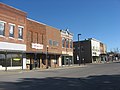 Railroad Avenue in Dawson Springs.jpg 2,816 × 2,112; 1.43 MB

.jpg)


.jpg)